Planowanie trasa poprzez ręczne tworzenie punkty trasa na mapie
Do zaplanować trasę poprzez ręczne tworzenie punkty trasa na mapie, najpierw otwórz planer trasa. Jeśli trasa jest obecna, dotknij przycisku z krzyżykiem, aby zresetować planer trasa.
Jeśli naciśniesz długo na mapie, pojawi się punkt trasa. Jeśli przytrzymasz palec na mapie, możesz przeciągnąć punkt trasa do żądanej pozycji. Jeśli następnie zwolnisz palec, punkt trasa zostanie ustawiony. Na Mac-OS można również nacisnąć klawisz Command-A, aby dodać punkt trasa w pozycji wskaźnika.
Przykład z jednym punktem trasa dodanym do mapy jest wyświetlony poniżej:
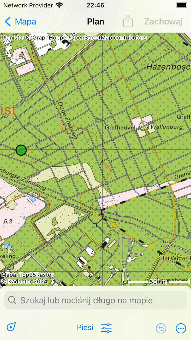
Po jedynczy punkt trasa jest dodawany ręcznie do mapy.
Dodany punkt trasa ma kolor zielony. Kolor zielony wskazuje, że punkt trasa został wybrany.
Możesz dodać drugi punkt trasa, naciskając długo na mapie. Ten będzie zabarwiony na niebiesko i wskazuje punkt trasa, który jest dodawany. Niebieski punkt trasa zawsze podąża za zielonym. Teraz musisz przeciągnąć niebieski punkt trasa do żądanej pozycji. Jeśli zwolnisz palec, trasa zostanie zaplanowana z zielonego do niebieskiego punktu trasa, jak widać poniżej:
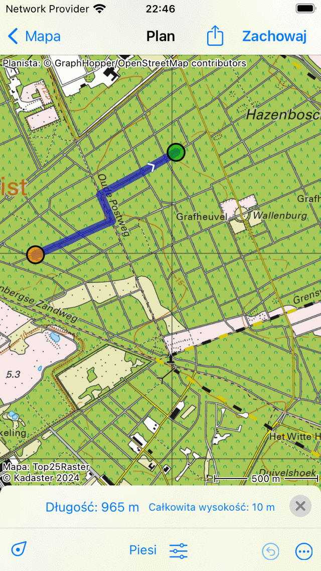
T rasa jest planowana między dwoma ręcznie dodawanymi punktami trasa.
Planując trasę, punkty trasa zostaną automatycznie przeniesione na najbliższą znaną drogę.
Zwolniając niebieski punkt trasa, zostanie on wybrane automatycznie i zabarwiony na zielono. Pierwotnie wybrane punkt trasa zostanie anulowany i zmieni kolor na pomarańczowy.
Długość planowanej trasa jest wskazana w nakładce planera trasa dół. Jeśli dotkniesz długości, mapa powiększy się do planowanej trasa. Również całkowite wzniesienie jest pokazane w nakładce. Jeśli dotkniesz całkowitego wznoszenia, możesz wyświetlić profil wysokości planowanej trasa.
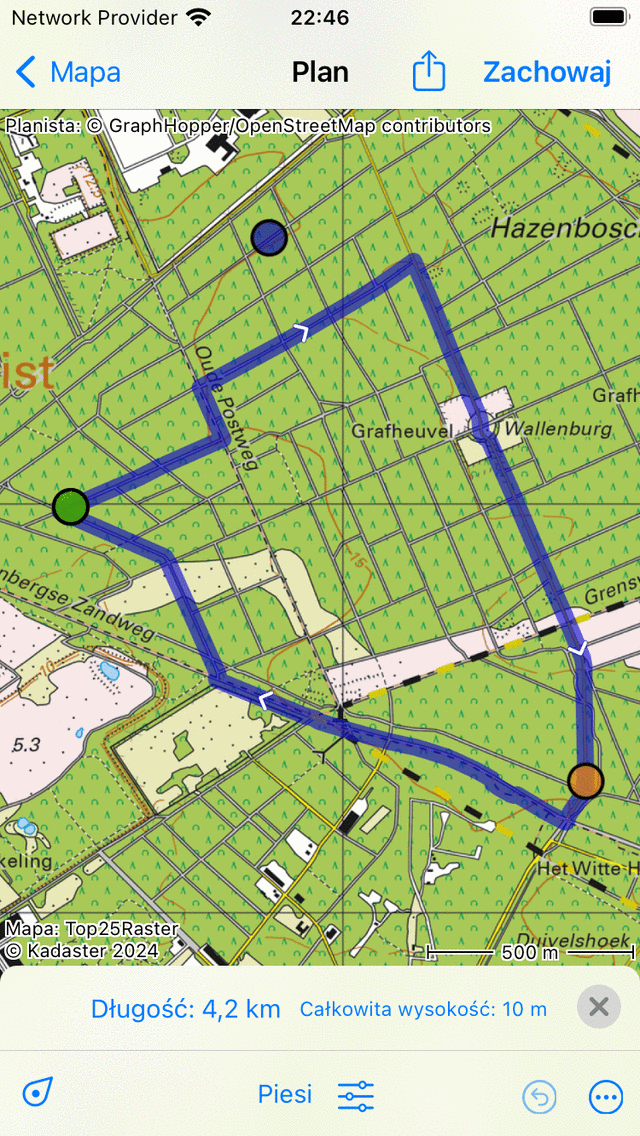
Do przedłużyć trasę, musisz dodać trzeci punkt trasa, naciskając długo na mapie. Przykład jest wyświetlany poniżej:
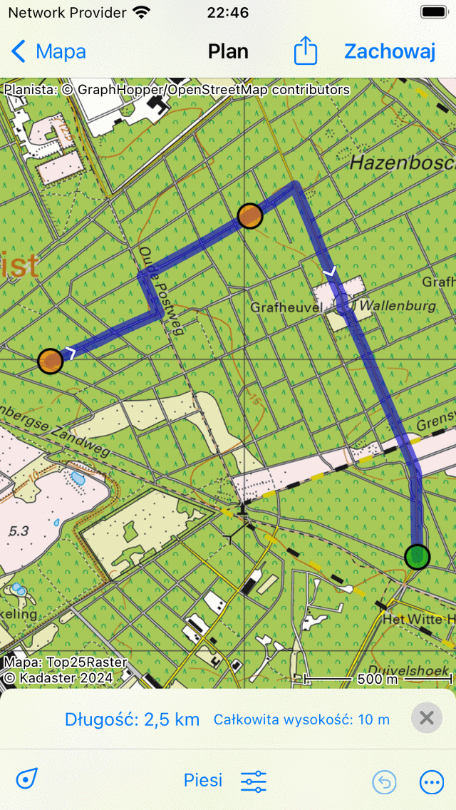
T rasa planowana jest przez trzy punkty trasa.
Planowanie podróży w obie strony
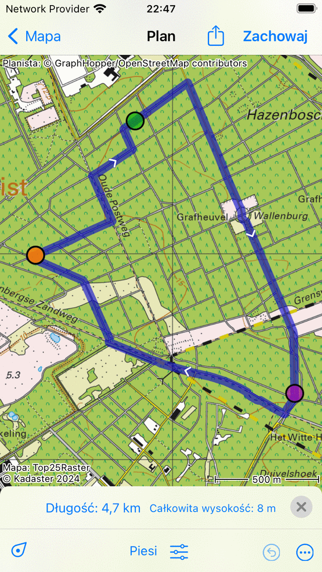
Do zaplanować podróż w obie strony, musisz najpierw utworzyć kilka punkty trasa, jak w powyższym przykładzie. Następnie dotknij pierwszego punktu trasa. Pojawi się wyskakujące okienko, w którym zostaniesz poproszony o zaplanowanie lub wybranie punktu początkowego. Jeśli dotkniesz opcji „Zaplanuj punkt startowy”, trasa zostanie zamknięta, jak widać w poniższym przykładzie:
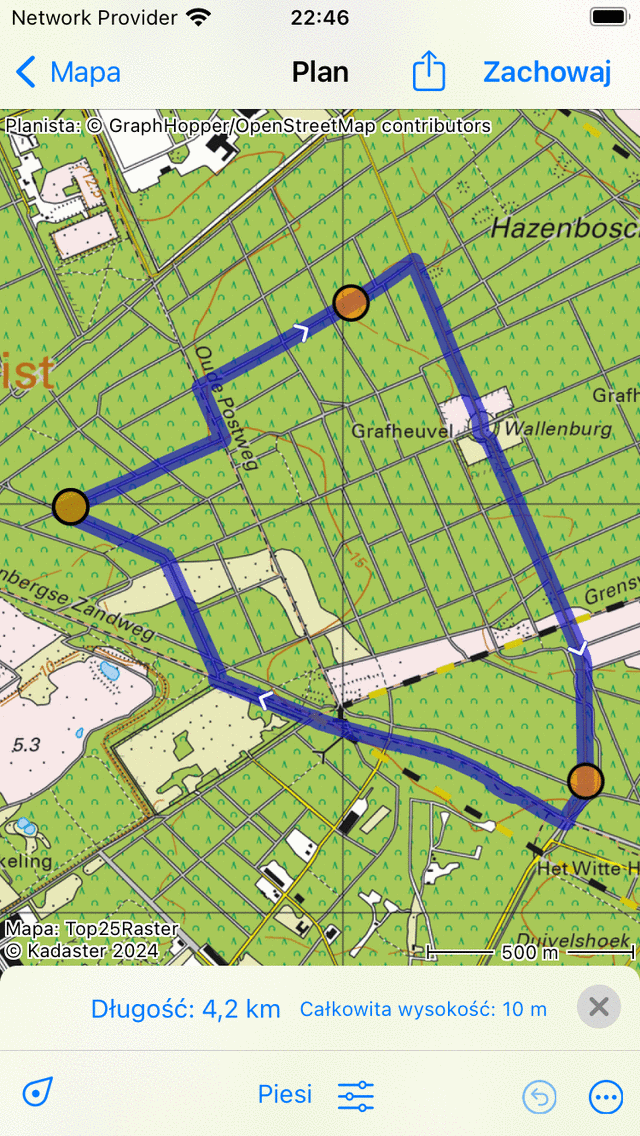
Trasa w obie strony zaplanowany jest przez trzy punkty trasa.
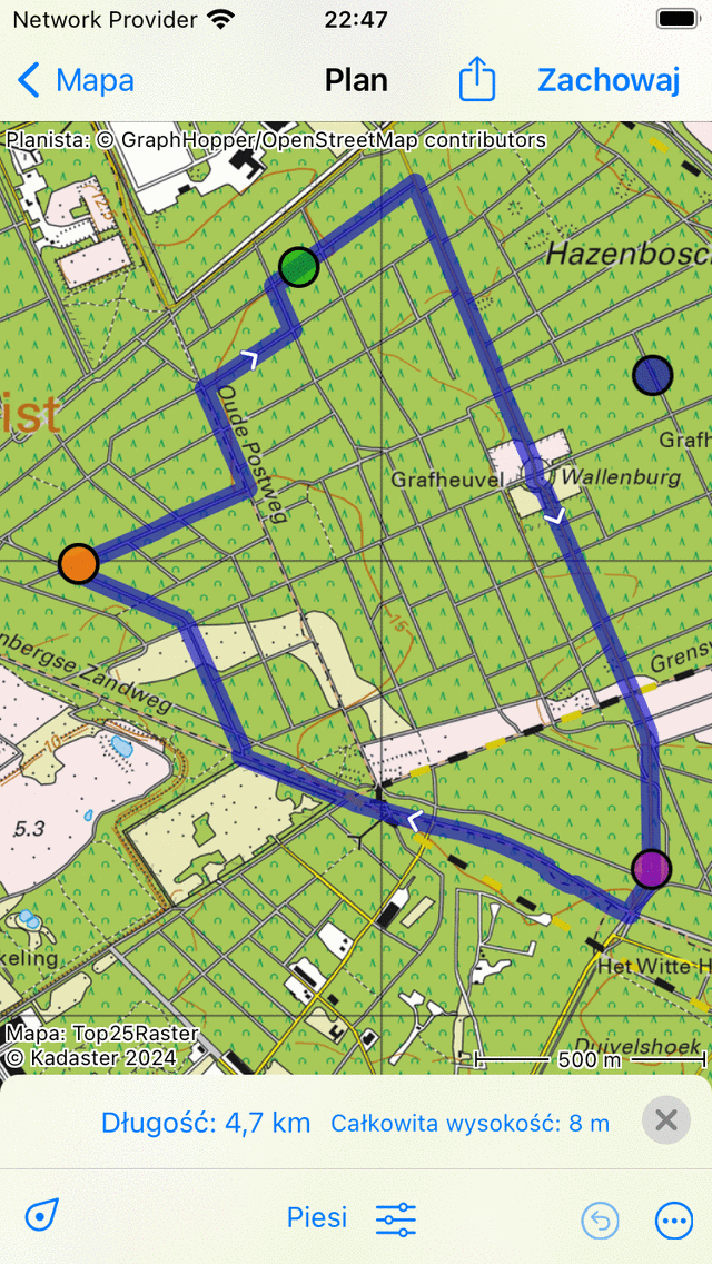
Wybór punktów trasa
Punkt trasa można wybrać, dotykając (naciśnięcie krótko) punktu trasa. Przyklejony punkt trasa stanie się zielony. Punkt trasa, który bezpośrednio podąża za wybranym punktem trasa, będzie miał kolor fioletowy. W ten sposób zawsze możesz odzyskać kierunek trasa. Wszystkie pozostałe punkty trasa będą miały kolor pomarańczowy.
Przemieszczanie punktów trasa
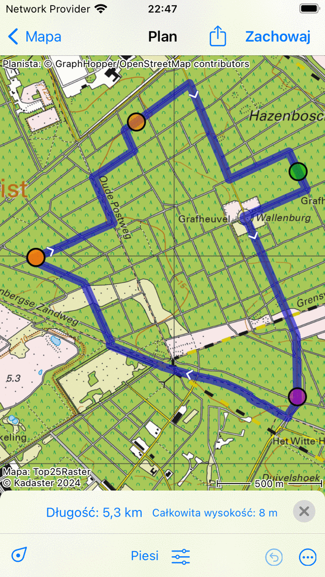
Do przenieść punkt trasa, najpierw wybierz żądany punkt trasa, dotykając go. Punkt trasa stanie się zielony. Następny naciśnij długo na wybranym punkcie trasa. Przytrzymaj palec na ekranie i przeciągnij punkt trasa do nowej pozycji. Przykład jest wyświetlany poniżej:
Przenoszenie punktu trasa.
Jeśli zwolnisz przeniesiony punkt trasa, nowa trasa zostanie obliczona automatycznie, jak widać w poniższym rysunku:
N owo zaplanowana trasa po przeniesieniu punktu trasa.
Wstawianie punktów trasa
Do wstawić punkt trasa pomiędzy dwoma istniejącymi punktami trasa, należy najpierw wybrać punkt trasa, który znajduje się tuż przed punktem trasa, który zamierzasz wstawić. Do wybrać punkt trasa, wystarczy go dotknąć (naciśnij krótko).
Jeśli wybrane punkt trasa nie jest ostatnim punktem trasa, zobaczysz fioletowy punkt trasa. Jest to punkt trasa, który bezpośrednio podąża za punktem zielonej trasa. Wstawiony punkt trasa zostanie wstawiony między zielony i fioletowy punkt.
Jeśli naciśniesz długo na mapie, pojawi się niebieski punkt trasa. Jeśli trzymasz palec na mapie, możesz przeciągnąć ten punkt do żądanej pozycji. Przykład jest wyświetlany poniżej:
Nowy punkt trasa (niebieski) zostanie wstawiony pomiędzy wybranym (zielony) a następującym punktem trasa (fioletowy).
Jeśli zwolnisz palec z ekranu, trasa między zielonym a fioletowym punktem trasa będzie teraz przechodzić przez wstawiony punkt trasa. Jest to zilustrowane na poniższym rysunku:
N owo planowana trasa przebiega przez wstawiony punkt trasa.
Jeśli nowa trasa została obliczona, wstawiony punkt trasa zostanie automatycznie wybrane i zabarwiony na zielono.
Możliwe jest również wstawienie punktu trasa na bieżącej trasa. Naciśnij długo na trasie, pojawi się nowy niebieski punkt trasa. Jeśli przesuniesz palcem, nowy punkt trasa może być przesuwany tylko wzdłuż linii trasa. Jeśli zwolnisz palec, punkt trasa zostanie wstawiony.
Usuwanie punktów trasa
Do usunąć punkt trasa, musisz najpierw wybrać żądany punkt trasa, dotykając go. Następny naciśnij długo na tym punkcie trasa, przytrzymaj palec na ekranie i przeciągnij go na górę lub dół ekranu. Zobaczysz, że punkt trasa znika. Przykład jest wyświetlany poniżej:
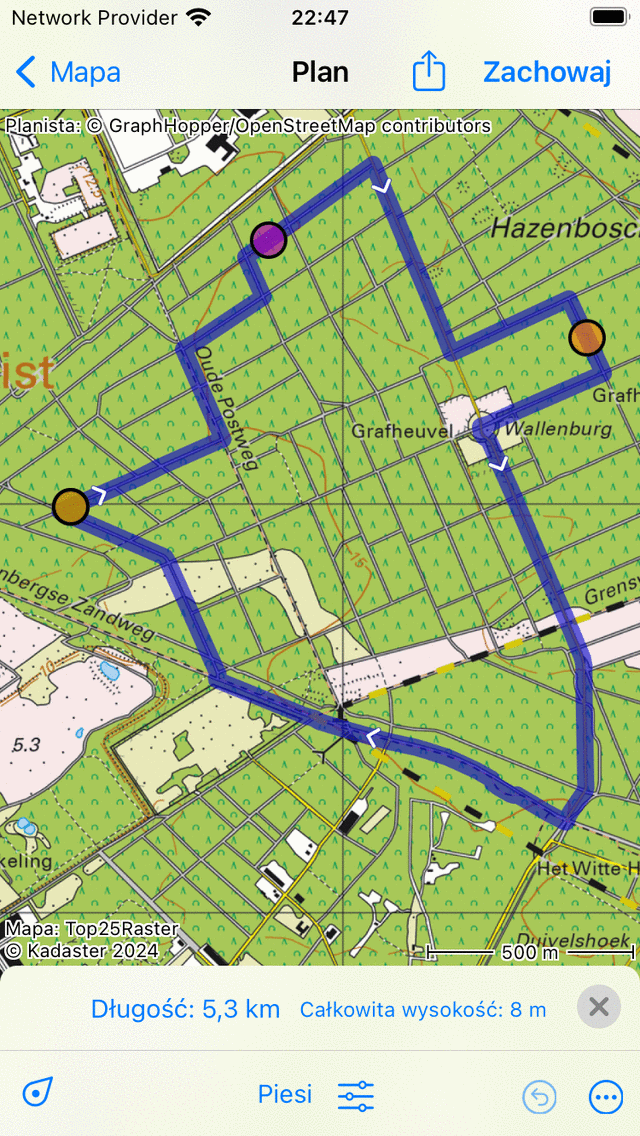
Usuwanie punktu trasa poprzez przeciągnięcie go top górę lub dół ekranu.
Jeśli przeciągnąłeś punkt trasa na dół lub górę ekranu, możesz go zwolnić. Punkt trasa zostanie usunięty, a trasa zostanie przeliczona, jak widać poniżej:
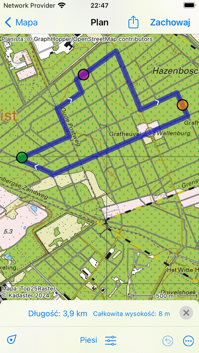
Trasa po usunięciu punktu trasa.