Planowanie trasa poprzez wprowadzenie nazwy lokalizacji
Do zaplanować trasę poprzez wprowadzenie nazwy lokalizacji, najpierw otwórz planer trasa. Jeśli trasa jest już zaplanowana, naciśnij przycisk krzyżowy, aby zresetować planer.
Jeśli dotkniesz paska wyszukiwania w nakładce planera trasa, pojawi się ekran, w którym możesz wprowadzić punkt początkowy i miejsce docelowe. Przykład pokazano poniżej:
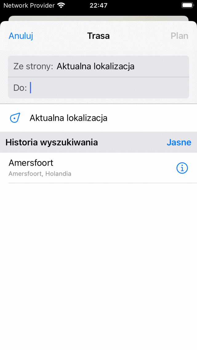
E kran, w którym można wprowadzić punkt początkowy i miejsce docelowe.
Twoja obecna lokalizacja jest automatycznie wypełniana jako punkt początkowy, wystarczy wpisać miejsce docelowe. Jeśli chcesz użyć innego punktu początkowego, po prostu wpisz nazwę innej lokalizacji w polu „Ze strony:”.
Jako przykład wpisaliśmy „Amersfoort” w polu „Do”. Jeśli teraz dotkniesz „Plan” w prawo górnym rogu lub dotkniesz lokalizacji na liście wyników wyszukiwania, powrócisz do ekranu planu i zostanie zaplanowana trasa z Twojej obecna lokalizacja do „Amersfoort”, jak widać w poniższym przykładzie:
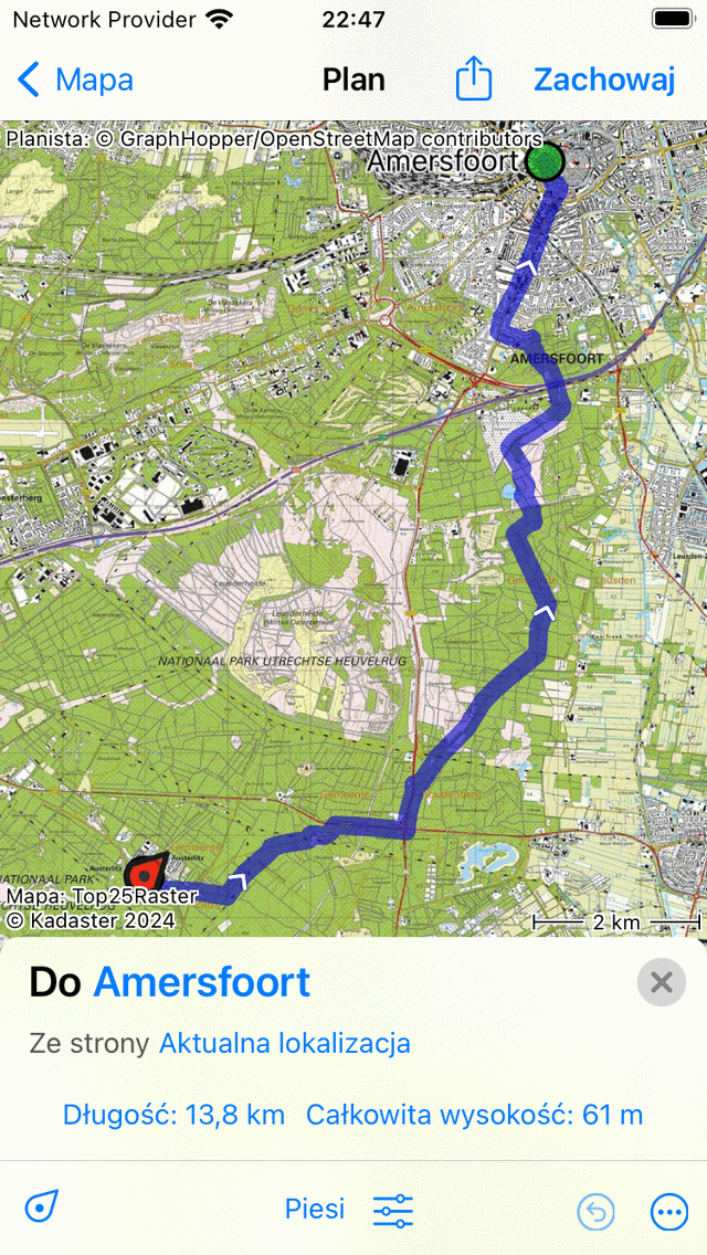
Zaplanowano trasę z Twojej obecna lokalizacja do „Amersfoort”.
W nakładce planera trasa pokazano miejsce docelowe i źródło planowanej trasa, jak widać na powyższym rysunku. Jeśli je dotkniesz, można je zmienić. Ponadto pokazana jest długość trasa. Jeśli dotkniesz długości, mapa zostanie powiększona do planowanej trasa. Wyświetlane jest również całkowite wzniesienie, jeśli go dotkniesz, możesz wyświet lić profil wysokości planowanej trasa.
Jeśli naciśniesz „Zapisz” w prawym top rogu, możesz zapisać zaplanowany trasa.
Jeśli nie chcesz zapisywać trasa, możesz nacisnąć „< Mapa” w lewym górnym rogu, aby powrócić do ekranu głów nego. Planowana trasa będzie wtedy widoczna również na głównej mapie.
Jeśli dotkniesz linii trasa planowanej trasa na ekranie głównym, powrócisz do planera trasa.