Trasy załadunku
Do załadować trasę na mapie, musisz najpierw dotknąć przycisku trasa na pulpicie nawigacyjnym lub Menu > Trasy, aby otworzyć wyskakujące okienko trasa. Następnie dotknij elementu „Zapisane trasy”, aby otworzyć ekran zapisanych trasy. Ekran zapisanych tras zawiera wszystkie trasy, które są lokalnie zapisywane na urządzeniu.
Przykład ekranu zapisanych trasy jest wyświetlany poniżej:
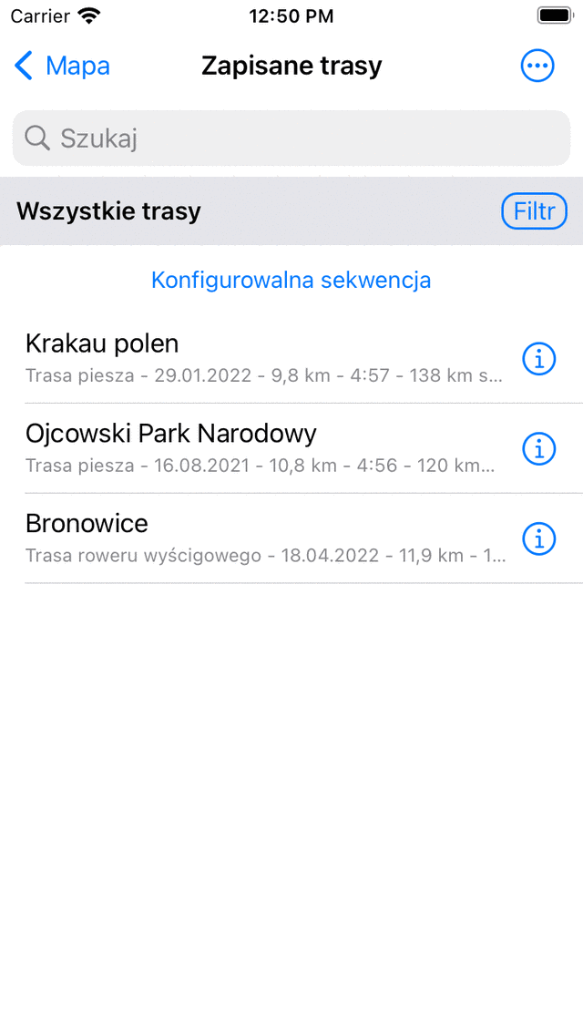
Przy kład ekranu „Zapisane trasy”.
Lista tras jest wyświetlana w ekranie zapisanych trasy. W powyższym przykładzie są trzy trasy.
Bezpośrednio pod tytułami tras widać typ trasy i długość trasa. Jeśli trasa jest rejestrowana, wyświetlany jest również czas trwania. Pokazana jest również odległość Twojej bieżącej lokalizacji do punktu początkowego lub końcowego trasa.
Do załadować trasę na mapie, musisz dotknąć tytułu preferowanej trasa.
Jako przykład załadujemy teraz ostatnią trasę na liście. Wynik pokazano w poniższym rysunku.
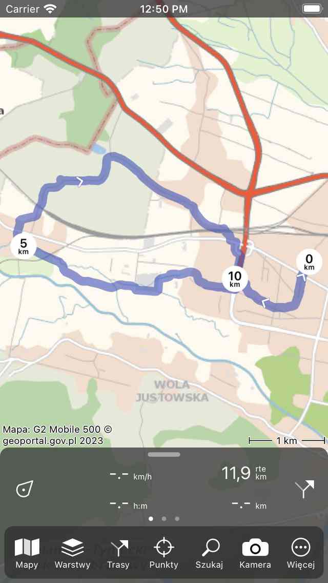
Trasa została załadowana na mapę.
Mapa porusza się i powiększa automatycznie, aby cała trasa była widoczna na mapie. Niebieska linia wskazuje trasa. biały strzałki na niebieskiej linii wskazują kierunek trasa. Okrągłe znaczniki odległości na linii trasa wskazują odległość na trasa.
Długość w prawo górnym rogu deski rozdzielczej wskazuje sumę długości wszystkich trasy, które są aktualnie załadowane na mapie. W tym celu używany jest symbol „rte”. Jeśli znajdujesz się na trasie, zamiast tego wyświetlana jest etykieta „dtg” (odległość do pokonania). Wskazuje odległość do końca trasa.
Jeśli chcesz zobaczyć trasę bardziej szczegółowo, możesz powiększyć mapę.
Jeśli podążasz drogą, możliwe jest otrzymanie powiadomienia, gdy przypadkowo opuścisz trasę, którą podążasz. Jest to przydatne, ponieważ z czasem zauważysz, że idziesz w złym kierunku. W tym celu należy włączyć opcję „Powiadomienia - Odejdź Zbocz z ostrzeżenia o trasie trasie” w Ustawienia Topo GPS. Następny musisz zezwolić Topo GPS na wysyłanie powiadomień w ustawieniach urządzenia. Radzimy również nagrać trasę, abyś mógł również otrzymać powiadomienie, gdy aplikacja jest w tle. Powiadomienia są wysyłane tylko raz, jeśli odchodzisz z trasa większej niż 25 m.
Jeśli dotkniesz linii trasa na ekranie głównym lub przycisku info (i) po prawej stronie ekranu zapisanych tras, zostanie otwarty ekran szczegółów tras y. Na ekranie szczegółów trasa można znaleźć więcej informacji o trasa, na przykład tytuł, opis i profil wysokości.
Możesz zmienić kolor, szerokość i przezroczystość linii trasa na ekranie szczegółów trasa, stukając Edycja > Edytuj styl linii.
Jeśli ponownie otworzysz ekran tras y, zobaczysz, że załadowana trasa uzyskała szary kolor tła, jak w poniższym przykładzie:
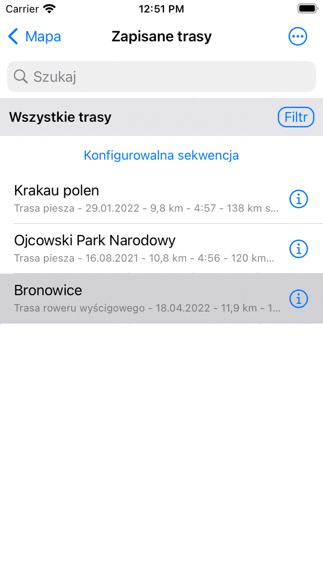
Na ekranie trasa widać, że ostatnia trasa została załadowana na mapie.
Szary kolor tła w ekranie trasy wskazuje, że trasa jest aktualnie wczytana na mapie.
Możliwe jest również załadowanie wielu trasy na mapie. Może to być przydatne, jeśli chcesz połączyć lub porównać różne trasy. Jeśli dotkniesz innej trasy na ekranie tras, zostanie ona dodana do mapy, podobnie jak pierwsza załadowana trasa. Kolor linii trasa będzie różny z pierwszej trasa.
Możliwe jest również załadowanie wielu trasy jednocześnie. Stuknij długo na trasie na ekranie trasy, aby włączyć ekran wyboru. Następnie wybierz żądane trasy i dotknij ikona mapy w dolnym pasku narzędzi.
W następnej sekcji wyjaśniono, jak usunąć trasę z mapy.