
Topo GPS app
Turn your iPhone, Android phone or tablet into a full featured GPS device with offline available topographic maps


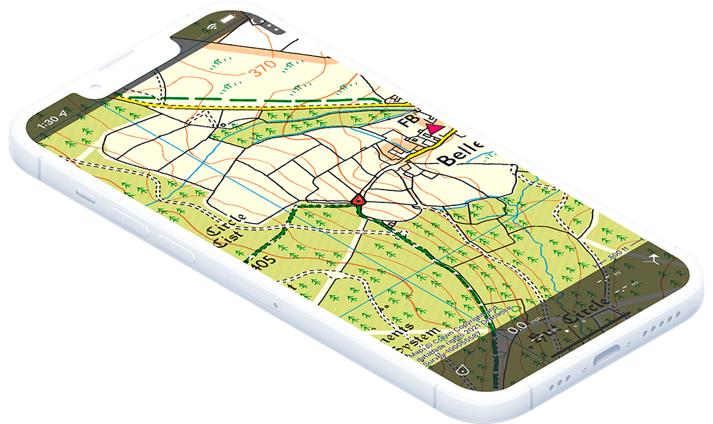
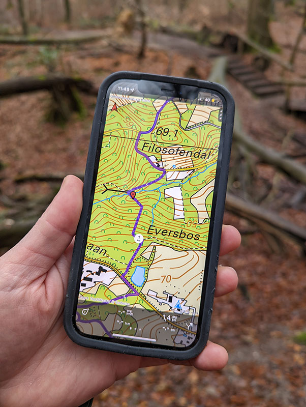
Topographic maps
The Topo GPS app contains official topographic maps of many countries. These are the best maps for outdoor activities. The maps can be made accessible offline.
Full GPS features
Topo GPS includes all functions of a regular GPS device, has accurate location determination and efficient battery usage.
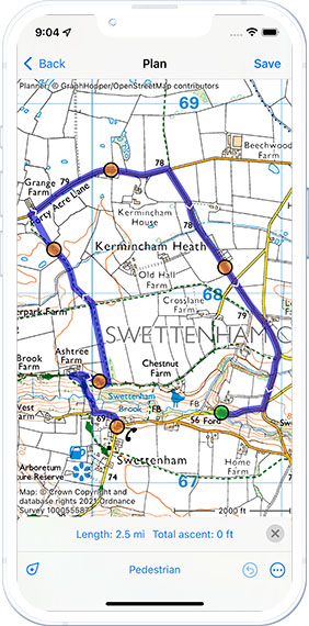
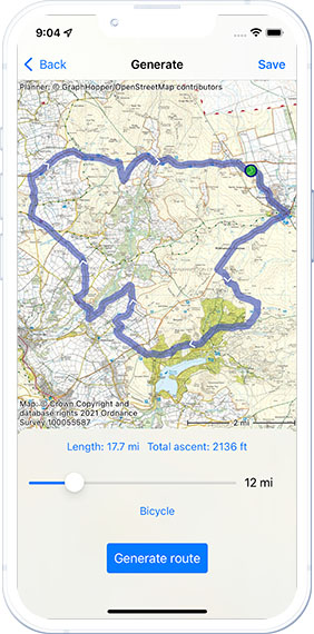
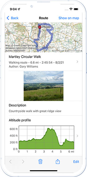
Route tool
Topo GPS is very suitable for following routes. You can import, record, plan, generate and share your routes. You can view and import routes that are shared with Topo GPS by other users.
Waypoints
In Topo GPS you can easily place waypoints on the map. A description can be added. Viewing, entering and scanning coordinates is easy. Many coordinate systems are supported.
Layers
In Topo GPS you can optionally add layers to the map, like for example ‘Mountainbike routes’ and coordinate grids.
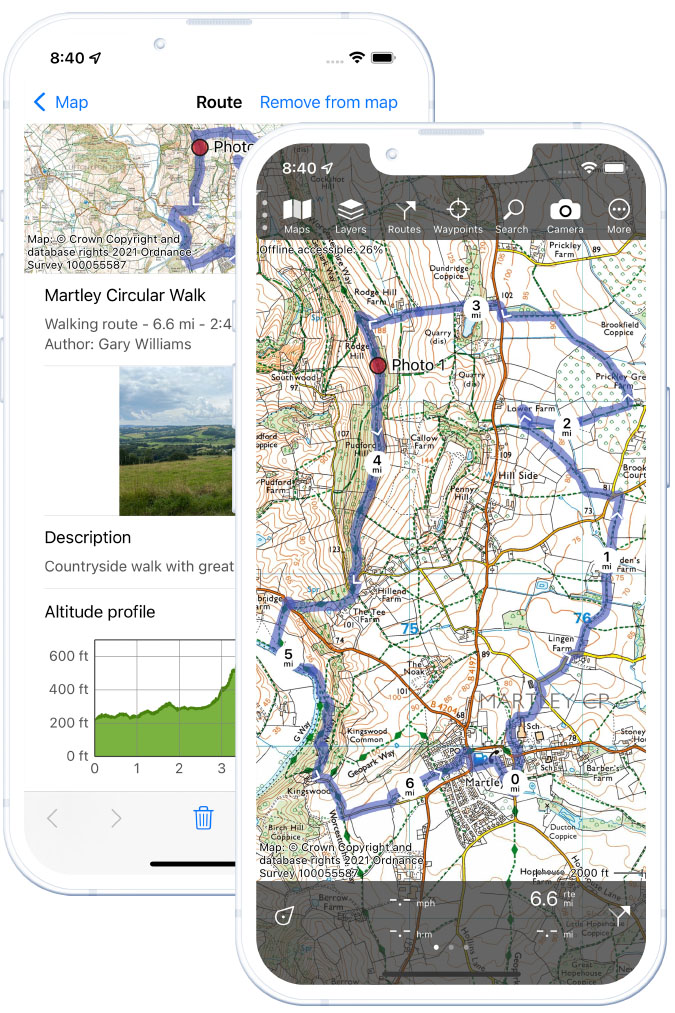
Photos
You can take photos in Topo GPS and add them to waypoints and routes.
Geodata formats
Topo GPS can import and export geodata in the following formats: gpx, kml/kmz, csv, zip. On iOS also WFS and geojson are supported.
Support
Topo GPS has an extensive manual and a very capable customer service.
Privacy focused
Topo GPS cares very much about your privacy. Topo GPS does not have user accounts. We cannot view any of your data. We do not collect your data. We do not show ads.
Reliable
Topo GPS exists since 2012. Free updates for Topo GPS appear several times a year. Each day thousands of people use Topo GPS as outdoor companion.
Screenshots
User reviews
“This is an excellent map and route planning app. The developer has been very responsive to making changes and additions…”
⭐⭐⭐⭐⭐ MikeWhyatt
“This is the best hiking map app I’ve tried so far. The topo info is accurate and detailed. The app itself is simple to use.”
⭐⭐⭐⭐⭐ hoosicboy
“Just what I was looking for! Wasn’t happy to buy huge maps or subscribe when I only hike occasionally.”
⭐⭐⭐⭐⭐ Dokmartyn
“Helps me plan and share my hiking routes, wonderful to use offline so I never get lost, don’t leave home without it!”
⭐⭐⭐⭐⭐ Tawhai Moss
Use cases
Topo GPS is used by hikers, bicyclists, mountaineers, geocachers, search and rescue teams, conservationists, and other people going outdoors.
Hiking
Offline official topographic maps with smallest paths in combination with its route capabilities make Topo GPS ideal for hiking.
Mountaineering
Clear and accurate topographic maps with height contours and rock formations make Topo GPS ideal for navigating in the mountains.
Bicycling
Detailed topographic maps, dedicated bicycle layers, route capabilities and a clear dashboard make Topo GPS the preferred navigation app.
Geocaching
The ease of scanning, entering, and viewing coordinates makes Topo GPS the tool for Geocaching.
Conservationists
Conservationists use Topo GPS for nature inventarisations. Waypoints can be used to mark and find important places.
Search and rescue teams
Search and rescue teams use Topo GPS for navigation during a mission. The accuracy and reliability make it the number one navigation tool.
Other professionals
Topo GPS is also used by forest firefighters, the military and archeologists.
Devices
Seamless integration between iPhone, Apple Watch and MacOS. And available on Android smartphones and tablets
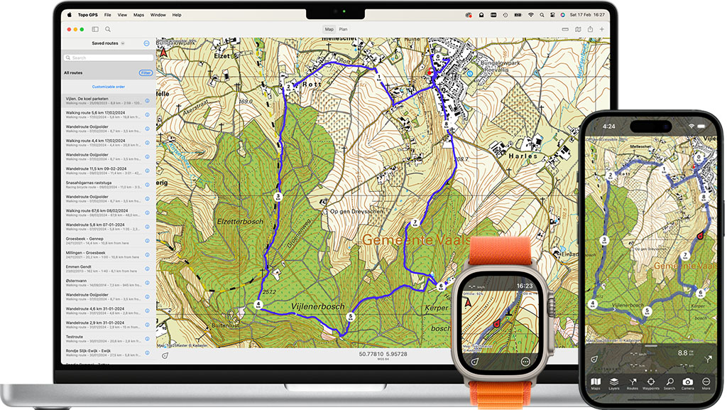
iOS / MacOS
Topo GPS runs on iPhones, iPads, Apple Watch and Apple Macs. Routes and points can be shared automatically between all devices via iCloud. Map purchases are available on all devices.
Android
Topo GPS runs on all Android phones and tablets (minimal Android 7) and Chromebooks. Google Play is required. On a Windows PC you can run Topo GPS using an Android emulator.
Our values
GPS device on a smartphone
Our mission is to turn your smartphone in a fully capable GPS device with topographic maps. Future development of Topo GPS will be along this direction.
Intuitive use
We aim to keep Topo GPS simple and intuitive to use. You do not need to understand the many advanced functionalities to operate Topo GPS.
Low prices
We offer topographic maps for very low prices. Topographic maps for most countries cost only €4,99/£3.99/$4.99 each including future updates.
Privacy focused
Your privacy is very important to us. Our only source of income is the sale of the maps and layers in the app. We cannot view your data, we do not collect your data, we do not show adds, and we do not sell any of your data.
No account
To use Topo GPS you never have to create an account. This guarantees you that we do not know your identity. Your purchases are associated to your Apple ID or Google Play account.
200K+
monthly active Users
28
Topographic maps
58k+
Ratings
4.5
Average rating