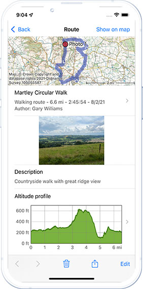
Topo GPS is used by many professional users
The app is widely used for navigation, data logging and data layers. The app has many active users from military, environmental researchers, SAR, infrastructure inspection amongst others.
Can I integrate my own data?
You can put your data in for instance a GPX file and then import it. Have you and your team change it and then export it with the added data integrated.
Can I share data to my own databases?
You can upload data in different formats as mentioned above. Potentially adding an icon to identify the item on the map.
Does Topo GPS work with my GIS software
Most of our data formats are compatible and importable by the common GIS software like ArcGIS and QGIS
What data formats do you support
Yes, Topo GPS supports a large number of Geo Data Formats and data types, both for import as well as export.
What can I do with GEO-JSON
Geo JSON allows you to add data to the map like borders or lines that can be used to show which areas should be surveyed for instance
Do you have a specific professional version
All our features are available for all our customers. We are thinking of a potential business focused version with custom features. If you are interested, leave us a comment on the contact page.
Can you build a custom feature for me
We have very limited development resources. That is why we are currently focusing on features for all customers.
Can I order Topo GPS in bulk
Yes, that is possible. Please contact us for a quote for a bulk order of apps.

GEO-JSON imports
Use the GEO-JSON format to display boundaries or other graphical layers on the topographic maps.
GPX file import and export
You can import geo-data files to load professional data points and tracks. Or create the data and export it.
Waypoint maps
Save data on the map with extra data or pictures to log geographic data.
Custom icons
Distinguish different type of data points by adding custom icons to waypoints.
Multiple coordinate formats
Each sector uses their own geo-data format, Topo GPS has supports nearly any format.
Coordinate grids
You can divide your project in logical sections using the build in grid-layers.