USTopo topographic map of the United States on your iPhone, Android phone and Apple Watch


Best outdoor maps for the United States
Official USTopo topographic maps of the US Geological Survey are the best outdoor maps for the USA.
The United States is a vast country with a diverse range of landscapes, from mountains and deserts to forests and beaches, offering a wide variety of outdoor activities for all interests and abilities.
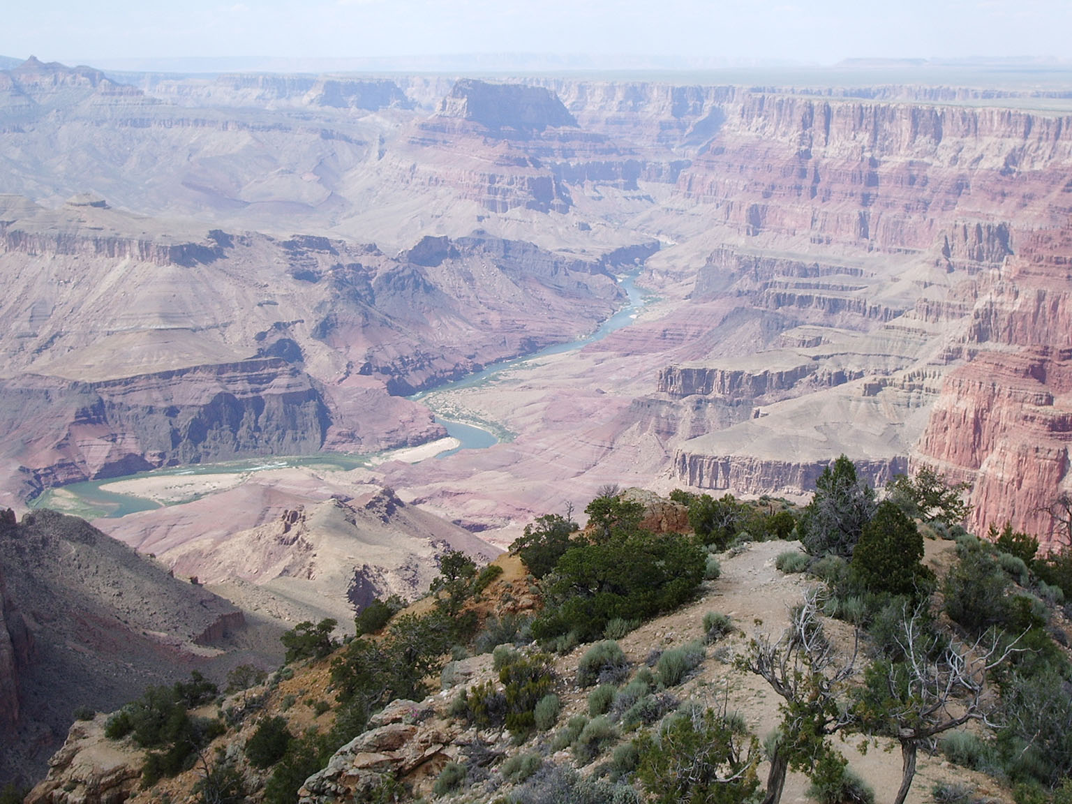
Hiking is a popular activity in the United States, with many national parks and wilderness areas offering breathtaking trails and stunning views. Some of the most popular hiking destinations include the Grand Canyon in Arizona, Yosemite National Park in California, and the Appalachian Trail, which spans from Georgia to Maine.
Skiing and snowboarding are popular winter activities in many parts of the United States, with world-renowned ski resorts located in states such as Colorado, Utah, and Vermont. The Rocky Mountains offer some of the best skiing in the country, while the resorts in Vermont and New Hampshire offer a more traditional East Coast skiing experience.
Water sports are also popular in the United States, particularly along the coastlines and in the many lakes and rivers across the country. Surfing, paddleboarding, kayaking, and fishing are just a few of the activities that visitors can enjoy. Popular water sports destinations include Hawaii, California, Florida, and the Great Lakes region.
For those who enjoy extreme sports, there are plenty of options in the United States, such as rock climbing, mountain biking, and whitewater rafting. The Moab region in Utah, for example, is a popular destination for mountain biking and rock climbing, while the Colorado River is a favorite for whitewater rafting.
Overall, the United States offers a wide range of outdoor activities for visitors to enjoy, from hiking and skiing to water sports and extreme sports. With so many different landscapes and regions to explore, there is always something new and exciting to discover in the great outdoors of the United States.
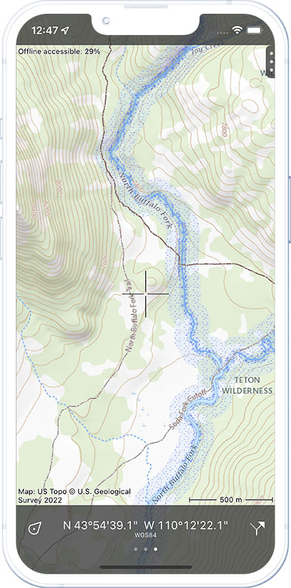
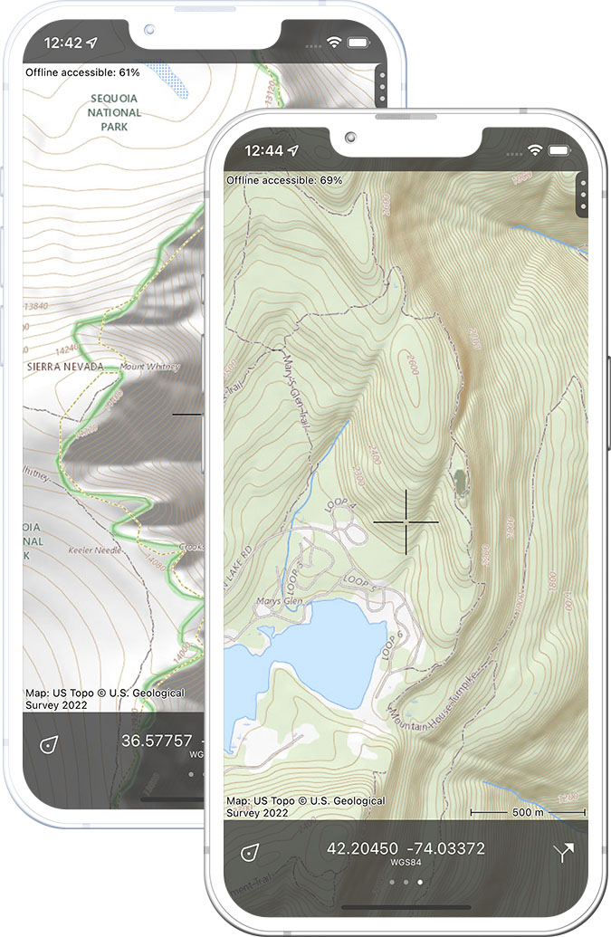
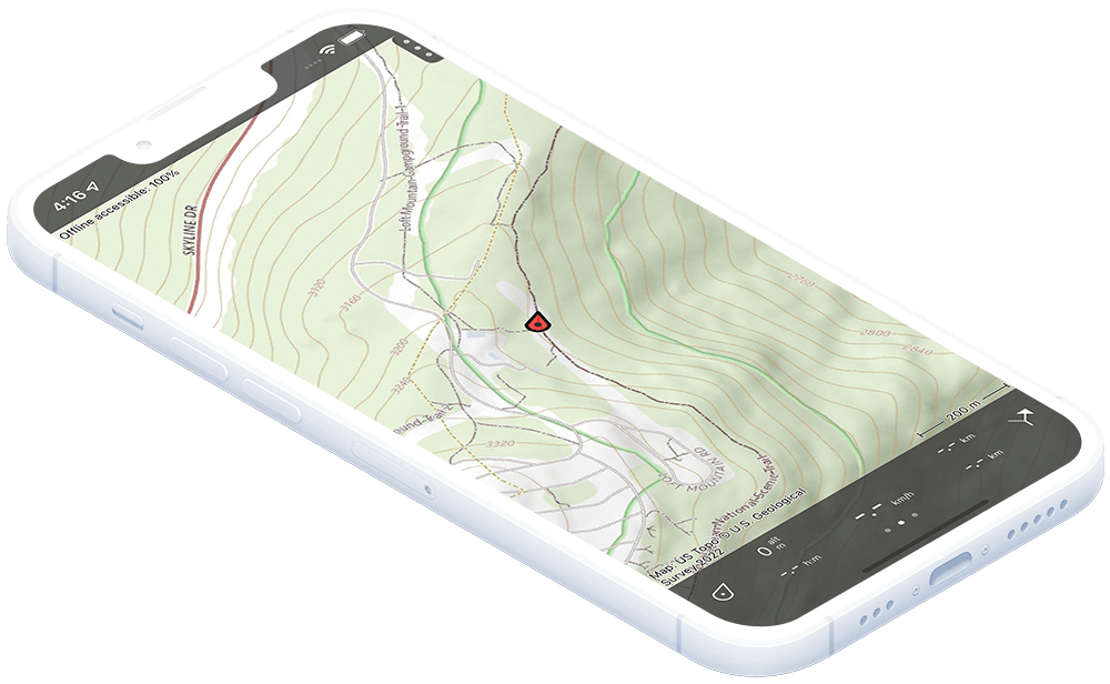
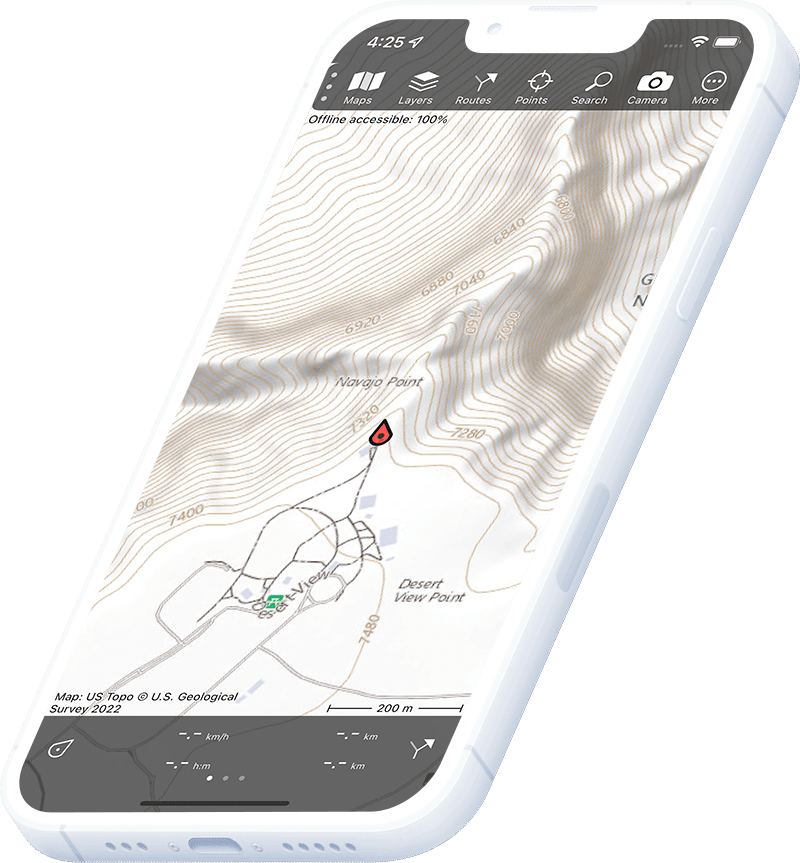
Topographic map
A topographic map contains many details like height contours, small roads and land usage and is thus ideal for navigating outdoors.
USTopo
In Topo GPS you can purchase full acess to the complete USTopo topographic maps of the United States. The USTopo topographic maps are produced by the US Geological Survey. In addition to the US Topo maps, we offer also aerial imagery of the USA.
Pricing
Full access to the complete USTopo topographic maps of the United States costs $3.99. This is a one-time purchase and includes free future updates. The map is available on all devices that share the same Apple ID or Google Play account.
Offline maps
You can make the topographic maps offline available. In this way you are sure that the maps you need are always accessible.
Clear legend
The topographic map has a clear legend with explanations of all symbols.
Topo GPS app
The Topo GPS app offers many additional useful features to the topographic map. Like navigating, loading, planning and following routes and adding points to the map. Topo GPS contains all functions of a regular GPS device.
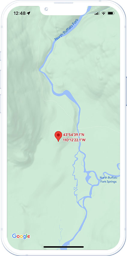
Which map would you prefer to explore the outdoors?
Compare yourself
Google maps
OpenStreetMap
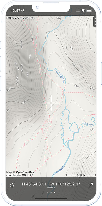
Topographic map
Turn your iPhone, Android phone or tablet into a full featured GPS device with offline available topographic maps.