
Topografische kaarten voor outdooravonturen
Hoogwaardige officiële topografische kaarten van 23 landen, offline beschikbaar op je iPhone, Android en Apple Watch.
Blader door kaarten per land
Selecteer een land om de kaartdetails, prijzen en downloadlinks te bekijken.
Australia
Geoscience Australia
 New South Wales€2.99
 Queensland€2.99
 South Australia€3.99
 NSW aerial imagery€3.99
 Queensland aerial imagery€3.99
Austria
BEV
 KM50-R 1:50,000€4.99
 Aerial imagery€3.99
Belgium
NGI
 Full topo subscription€13.99/yr
 Regional purchase€0.99+
Czech Republic
ČÚZK
 ZM50 1:50,000€3.99
Denmark
SDFI
 Danish topo€3.99
Estonia
Maa-amet
 Estonian topo€3.99
Faroe Islands
Landmælingar Føroya
 Faroer islands€3.99
 Aerial imagery€3.99
Finland
Maanmittauslaitos
 Basic map 1:20,000€3.99
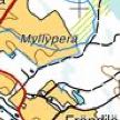 Finland 1:50,000€2.99
France
IGN
 SCAN25 subscription€19.99/yr
- Aerial imageryincl.
- Aeronautical chart
- Guadeloupe / Martinique
- French Guiana
- Mayotte / La Réunion
- Saint-Pierre-et-Miquelon
- Saint Martin / Barthélemy
Germany
BKG
 DTK25 1:25,000€3.99
 Bayern aerialincl.
 Mecklenburg-Vorpommernincl.
 Nordrhein-Westfalen€1.99
 Schleswig-Holstein€3.99
- Hessen€4.99
 Brandenburg€3.99
- Baden-Württemberg€4.99
 Sachsen€1.99
Great Britain
Ordnance Survey
 OS Landranger 1:50,000€0.99/1024km²
 Full GB subscription€24.99/yr
 Isle of Man€2.99
Japan
GSI
 GSI topo€3.99
 Aerial imagery€4.99
Lithuania
NŽT
 TOP50LKS Lithuania€3.99
Aerial imagery€3.99
Luxembourg
ACT
 Topo 5k Luxembourg€3.99
 Aerial imagery€3.99
The Netherlands
Kadaster
 Top25Raster 1:25,000€3.99
- Netherlands 1:50,000incl.
- Netherlands 1:100,000incl.
- Aerial imagery€3.99
New Zealand
Land Information NZ
 NZ Topo50€3.99
 Aerial imagery€3.99
 Antipodes Islandsincl.
 Auckland Islandsincl.
 Campbell Islandsincl.
 Chatham Islandsincl.
 Cook Islands (east/west)incl.
 Kermadec Islandsincl.
 Niueincl.
 Ross Island / McMurdoincl.
 Snares / Bounty / Tokelauincl.
Norway
Kartverket
 N50Raster 1:50,000€3.99
 Norway 1:100,000incl.
- Svalbard€3.99
- Svalbard aerial imageryincl.
- Jan Mayenincl.
Poland
GUGiK
 BDOT10k Poland€2.99
 Aerial imagery€2.99
Romania
ANCPI
 Romanian topo€3.49+
Slovakia
GKÚ Bratislava
 ZBGIS Slovakia€3.99
 Aerial imagery€3.99
Slovenia
GURS
 DTK50 1:50,000€3.99
- Aerial imagery€3.99
Spain
IGN Spain
 MTN25 1:25,000€3.99
 Aerial imagery€3.99
Sweden
Lantmäteriet
 Karta25€3.99
- Karta50€3.99
Switzerland
Swisstopo
 1:25,000€3.99
 1:50,000€3.99
 1:100,000€3.99
- 1:10,000 (new)€7.99
 Aerial imagery€3.99
United States
USGS
 USGS National Map€3.99
 Aerial imagery
- Aerial + topo
World coverage
OpenStreetMap
Frequently asked questions
Everything you need to know about Topo GPS topographic maps.
Topo GPS is a navigation app for iPhone, iPad, Android, Apple Watch and Mac. It provides official high-resolution topographic maps for 23 countries, available fully offline — ideal for hiking, cycling, skiing and any outdoor adventure.
Yes. Topo GPS is free to download from the App Store and Google Play. Individual country topographic maps are purchased separately as in-app purchases, starting from €3.49.
Topo GPS currently offers official topographic maps for 23 countries across Europe, North America, Asia and Oceania. An OpenStreetMap world coverage map is also available for all other regions.
Yes. After purchasing a map, you can download the tiles to your device via Menu › Maps. Once downloaded, the map works fully offline — no Wi-Fi or mobile signal required.
Open Topo GPS, go to Menu › Maps › More maps, find your country in the Store and tap to purchase. Payment goes through the App Store or Google Play.
Topo GPS runs on iPhone, iPad, Apple Watch and Mac (iOS 15+, macOS 12+) and Android phones and tablets (Android 8+). One purchase covers all your devices on the same platform.
Yes. For one-time purchase maps, free lifetime updates are included. For subscription maps (France, Belgium), updates are included for the duration of the subscription.
Yes. Topo GPS has built-in route planning, GPX import/export, and GPS track recording. You can create routes on the topographic map, follow them with turn-by-turn guidance and share them with others.