
Topographic map of the Czech Republic on your iPhone, Android phone and Apple Watch


Topographic map of Czech Republic
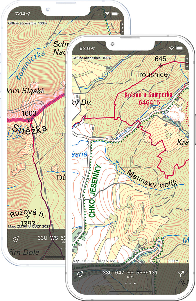
Topo GPS has topographic maps of the Czech Republic from ČÚZK. From the Krkonoše Giant Mountains to Šumava and Bohemian Switzerland, Czechia offers excellent forest and mountain hiking.
Download once, use anywhere — no signal needed.
See your exact position on the map as you move.
Record hikes, export GPX and share your tracks.
ZM50 1:50,000
Official Czech topographic map at 1:50,000 scale from ČÚZK.
Pricing
One-time purchase€3.99 one-time purchase, free lifetime updates included
€3.99
Where to hike in Czech Republic
Czech Republic offers the Giant Mountains ridge walk, Šumava forest highlands, Bohemian Switzerland sandstone towers and the Beskydy foothills.
The Giant Mountains — Sněžka (1,603 m) and the long ridge walk along the Polish border.
The Bohemian Forest — remote highlands, glacial lakes and the source of the Vltava river.
Dramatic sandstone rock formations — a UNESCO national park near Dresden.
Gentle forested Carpathian foothills in eastern Moravia.
Moravia’s highest range — Praděd (1,492 m) and mountain meadow trails.
Limestone hills above the Dyje river in southern Moravia.
Deeply wooded Dyje river gorge national park on the Austrian border.
The Eagle Mountains ridge on the Polish border.