
Topographic map of Norway on your iPhone, Android phone and Apple Watch


Topographic map of Norway
Topo GPS has topographic maps of Norway from Kartverket. Norway offers legendary fjord hiking, midnight sun trails and the famous Trolltunga, Preikestolen and Besseggen ridge.
Download once, use anywhere — no signal needed.
See your exact position on the map as you move.
Record hikes, export GPX and share your tracks.
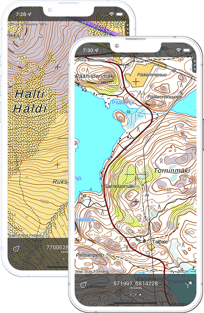
Norway topo 1:50,000
Official Norwegian topographic map at 1:50,000 scale from Kartverket.
Pricing
One-time purchase€3.99 one-time purchase, free lifetime updates included
€3.99
Norway topo 1:100,000
Norwegian topographic map at 1:100,000 scale from Kartverket.
Pricing
One-time purchase€2.99 one-time purchase, free lifetime updates included
€2.99
Where to hike in Norway
Norway offers the Besseggen ridge, Trolltunga, Preikestolen, Jotunheimen peaks and the spectacular fjord hiking of the Western Fjords.
Norway’s highest massif — Galdhøpiggen (2,469 m) and the Besseggen ridge above blue and green lakes.
The Pulpit Rock — 604 m above Lysefjord, one of Norway’s most visited viewpoints.
The Troll’s Tongue — a 700 m exposed rock ledge above Lake Ringedalsvatn.
Europe’s largest mountain plateau — the Oslo to Bergen Rallarweg rail trail.
Dramatic Arctic archipelago — razor ridges, midnight sun and fishing village trails.
The finest viewpoint in Norway — 2,000 m dome visible from one-sixth of Norway.
Norway’s first national park — rounded fells and the Rondeslottet (2,178 m) summit.
The 10 km panoramic ridge above Åndalsnes and Romsdalsfjord.