
Topographic map of Estonia on your iPhone, Android phone and Apple Watch


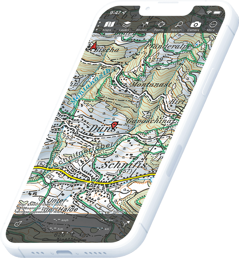
Topographic map of Estonia
Topo GPS has topographic maps of Estonia from Maa-amet. Estonia offers beautiful forest hiking, bog walking and island exploration across its unique Baltic landscape.
Download once, use anywhere — no signal needed.
See your exact position on the map as you move.
Record hikes, export GPX and share your tracks.

Estonian topo
Official topographic map of Estonia from Maa-amet.
Pricing
One-time purchase€3.99 one-time purchase, free lifetime updates included
€3.99
Aerial imagery
High-resolution aerial imagery of Estonia.
Pricing
One-time purchase€3.99 one-time purchase, free lifetime updates included
€3.99
Where to hike in Estonia
Estonia offers ancient forest trails, the wild bog landscapes of Soomaa, coastal cliffs at Pakri and island hiking on Saaremaa and Hiiumaa.
Estonia’s first and largest national park — ancient forests, coastal cliffs and manor houses.
Europe’s last great bog wilderness — the fifth season flooding and ancient canoe routes.
Estonia’s largest island — limestone cliffs, meteorite crater lake and juniper meadows.
Serene western island with lighthouse trails and wooded headlands.
Estonia’s highest point Suur Munamägi (318 m) in the forested southeast highlands.
Internationally important wetland — reed-beds and meadows for migratory birds.
Sandy beaches and pine forests on the Gulf of Riga.
Central Estonian bog national park — wooden boardwalks through ancient raised bog.