
Topographic map of Lithuania on your iPhone, Android phone and Apple Watch


Topographic map of Lithuania
Topo GPS has topographic maps of Lithuania from GIS-Centras. Lithuania offers forest hiking, the Curonian Spit UNESCO dunes, the Aukštaitija lake district and the trail networks of Dzūkija.
Download once, use anywhere — no signal needed.
See your exact position on the map as you move.
Record hikes, export GPX and share your tracks.
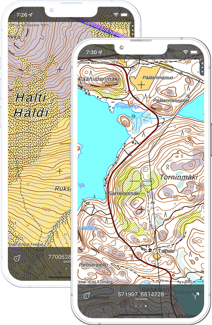
Lithuania topo 1:50,000
Official topographic map of Lithuania at 1:50,000 scale from GIS-Centras.
Pricing
One-time purchase€3.99 one-time purchase, free lifetime updates included
€3.99
Where to hike in Lithuania
Lithuania offers the Curonian Spit dune trail, Aukštaitija lake forest hiking, Žemaitija national park and the ancient hill-fort landscapes of Kernavė.
UNESCO World Heritage dune peninsula — the 50 km Amber Trail through pine forest and sand dunes.
Lithuania’s oldest national park — lakeland forests with ancient tribal paths.
Glacial lake plateau national park in northwest Lithuania — the Plateliai lake circuit.
The largest national park in Lithuania — mushroom forests and the Nemunas river valley.
Archaeological reserve of the ancient Lithuanian capital — hill-fort mounds above the Neris river.
Medieval island castle in a lakeland setting — forest trails and Karaite heritage village.
River delta regional park — wetland bird habitat and dyke-top walking routes.
UNESCO old town — Gediminas Hill tower and the Vilnia river valley park trails.